Hurricane Rita and Google Earth
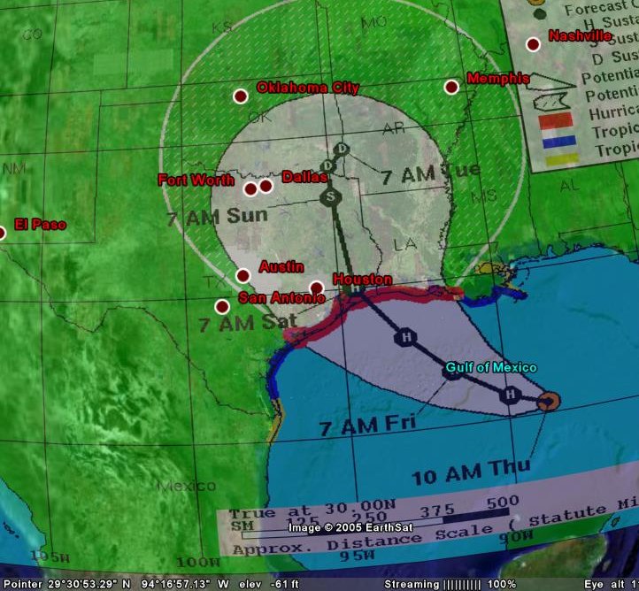
Thu, Sep 22, 2005 with tags googleearth , random , google , hurricanerita , ritaLike many people, I’m morbidly watching the upcoming disaster in south east Texas. I decided that now would be the time to play with Google Earth to see what it can do. I’ve been pretty impressed. Here’s a snapshot of what I just did:

Projected Path of Hurricane Rita overlaid on Google Earth
I’ve also posted a Hurricane Rita KMZ file for use with Google Earth. The images are links to the always updating ones on the National Weather Service’s page, so if they move the map much, you’ll get it all messed up. It also has links to the the wind maps for both tropical storm and hurricane force winds. Enjoy.